
|
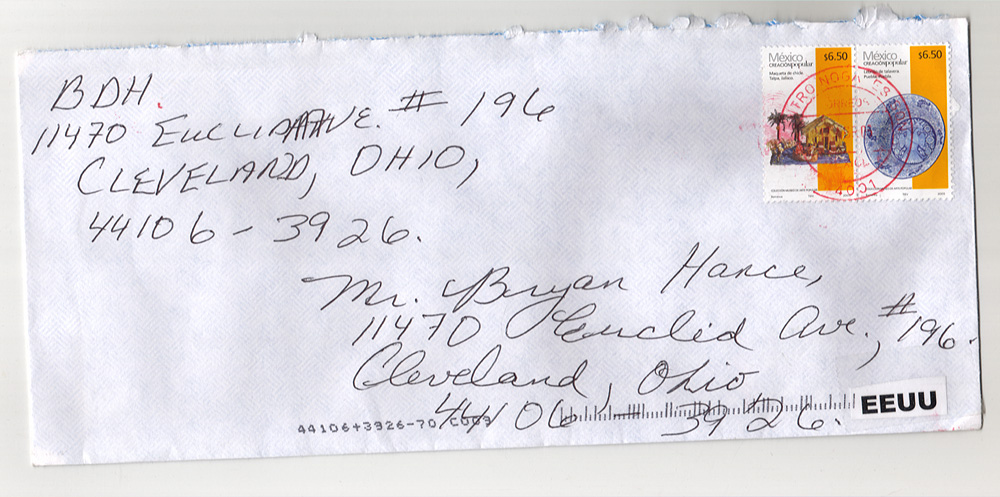
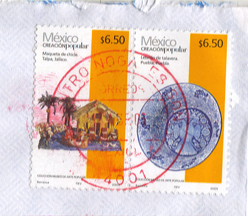
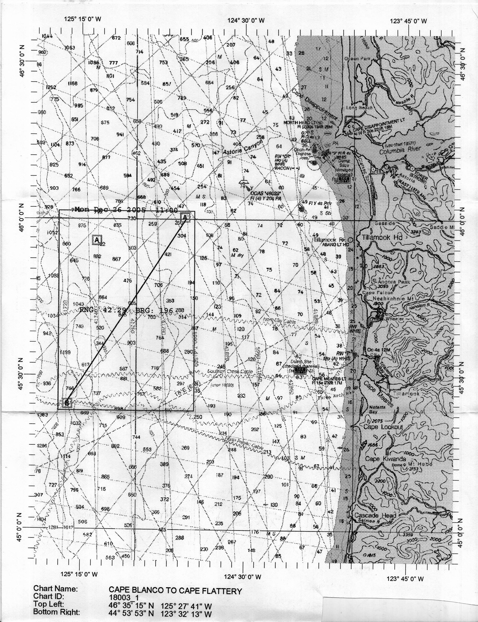
Letter contents: .. a nautical/sailing map, mailed from Mexico - "CAPE BLANCO TO CAPE FLATTERY". Jack D. 05.08.2006 Wow, I can't believe Is saw this. look at the smudge next to the stamp, the one that looks like a fingerprint. Around the middle, I think I see a pair of eyes. I'm not sure though. Beacon 05.10.2006 Cape Blanco to Cape Flattery - NOAA Nautical Chart (18003_1) you will get the chart here http://ocsdata.ncd.noaa.gov/ChartServerV2.0/jsp/index.jsp The letters RNG (range? in miles nauts kilometres?) and BRG (bearing? in degrees?) appear with a number following them. The page sent is a smaller area compared to the above chart Other differences: There is a box marked on the page with A and B and a line between them, a reference to an earlier MaYDAY POST? (Dec 26 2005 11AM) maybe not since a time is included. There are two boxes marked "see note". One may be an offshore military dump. Military land and see ranges have been used before in the postings. name: y Llamau clue: Both of the "see note" boxes were added to the image as were the Date above the rectangle. I found the nautical maps from NOAA and loaded them overlaying the image. The "see note" boxes reside on top of two (of a few) Cable lines marked on both the image and in the NOAA map dataset. The line drawn diagonal from BoxA to BoxB line up with Submarine Cable data (cables seem to be shown in a zig-zag line on the image). The prior 48 Hours showed the beginning of unsusually wet weather lasting until after the New Year for this area of NW US Coast. http://www.google.com/url?sa=t&ct=res&cd=1&url=http%3A%2F%2Foregonstate.edu%2F~readw%2FDecember2005.html&ei=m1N3RK-pEp_OqQLpmOGrAQ&sig2=EWX679iQgVrOs6x_sSbIPw Similar timing to Earthquake/Tsunami dates of the prior year. Prediction example again? Or hints at of causality? I note that the letters BRG as Bearing do not reflect the bearing of the diagonal line. However If RNG is in miles (non nautical) and using the Bearing as accurate the Other BoxA is used it seems to line up with a location also on (farther NW) the Cable under the first BoxA. Could this refer to a break in the Cable and a repair after the Gale winds on Christmas subsided on Dec.26? Maybe just a repositioning? Data Signal Tapping? theleakingpen 06.12.2006 note, those arent islands, those are trenches. both places that say see note appear to have marking underneath labeling them by salvage operations. also, line between a and b was added AFTER the map was printed, but then photocopied. the date, the see notes, the ticks and long lats around the endge, and the printing at the bottom are seperate and newer. also, i wonder whats missing on the bottom right... Click here to submit a clue for this page. |